MULTI-HAZARD UTILITY PLANNING & OPERATIONS
Extreme conditions require more clarity.
Wildfire. Floods. Winter storms. High winds. To predict and manage evolving weather threats, Technosylva’s analytics transform complex weather data into practical tools for utility planning, mobilization, and response.
Manage multiple hazards in one view.
Extreme events create the largest potential damages, and key decisions make a difference in impact and cost. Technosylva’s AI-based platform seamlessly integrates multi-hazard science and diverse data sources to provide a unified risk picture–enabling real-time decision-making, with precision.
Wildfire
Industry-leading fire science
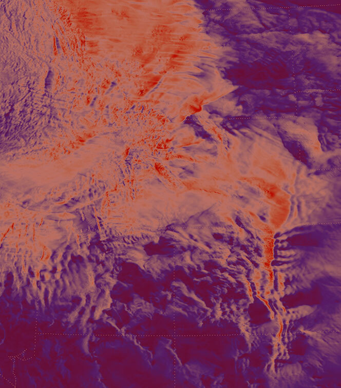
Combine real-time fire behavior modeling and AI-driven risk forecasting to prevent, anticipate, and respond to wildfires with field-proven insights.
Flooding
Precision flood-risk insights
Leverage comprehensive flood modeling to assess asset-level risk and support targeted operational and planning decisions.
Extreme Weather
Forecast-informed actionable next steps
Plan and mobilize for outages and grid damages day in advance of extreme weather to reduce restoration times and “get the lights back on” faster.
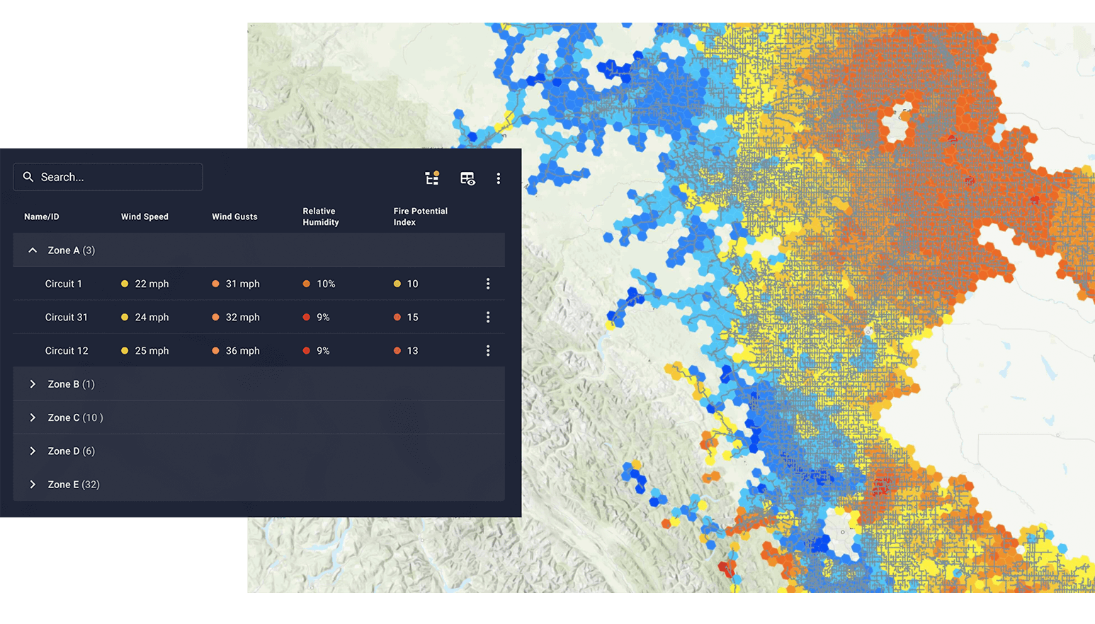
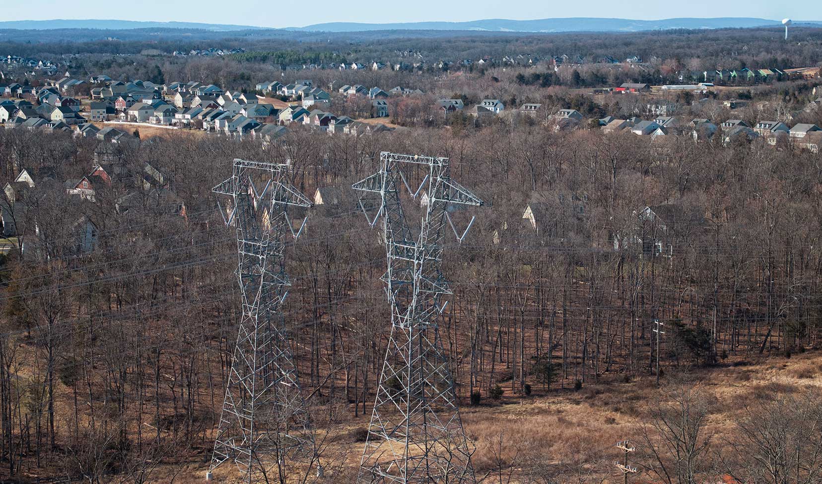
WILDFIRE
Comprehensive risk intelligence
-
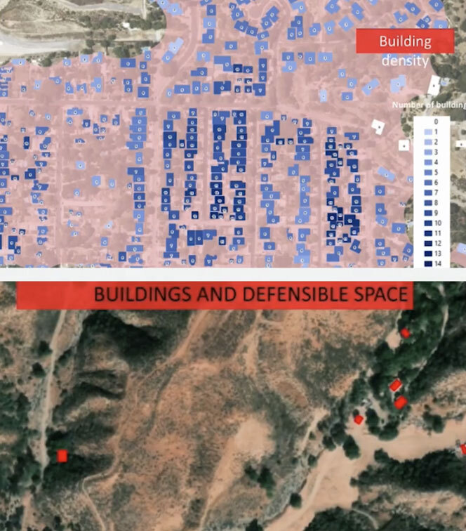
Prioritize mitigation investments using insights from historical weather, climatology, and millions of validated fire simulations. Our models combine proven science with asset-specific data to help you plan for long-term resilience and reduce catastrophic outcomes.
-
Trusted by leading fire agencies and utilities, our AI- and science-based models support critical operational decisions around near-term mitigation, resourcing and placement, and PSPS events —providing the granularity and accuracy critical to high-stakes operations.
Learn More
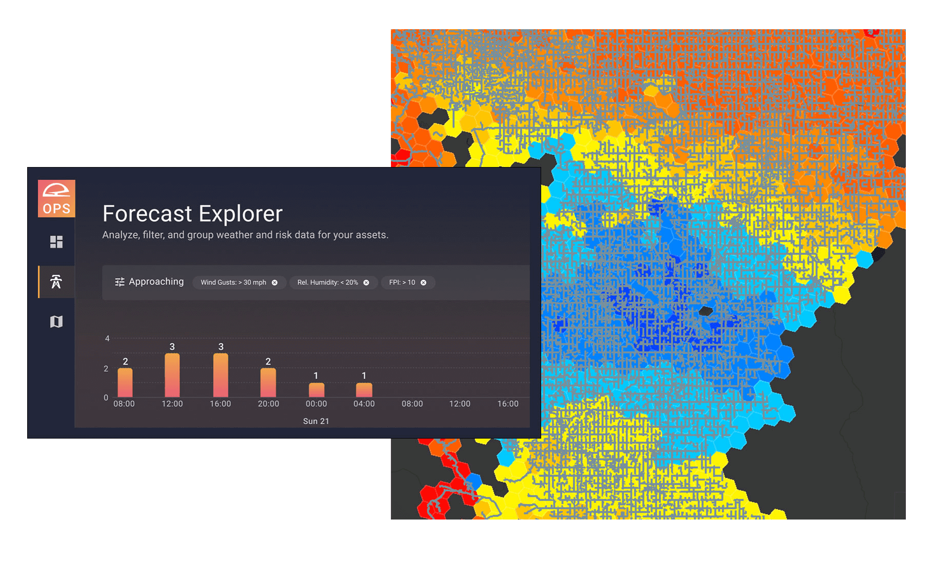
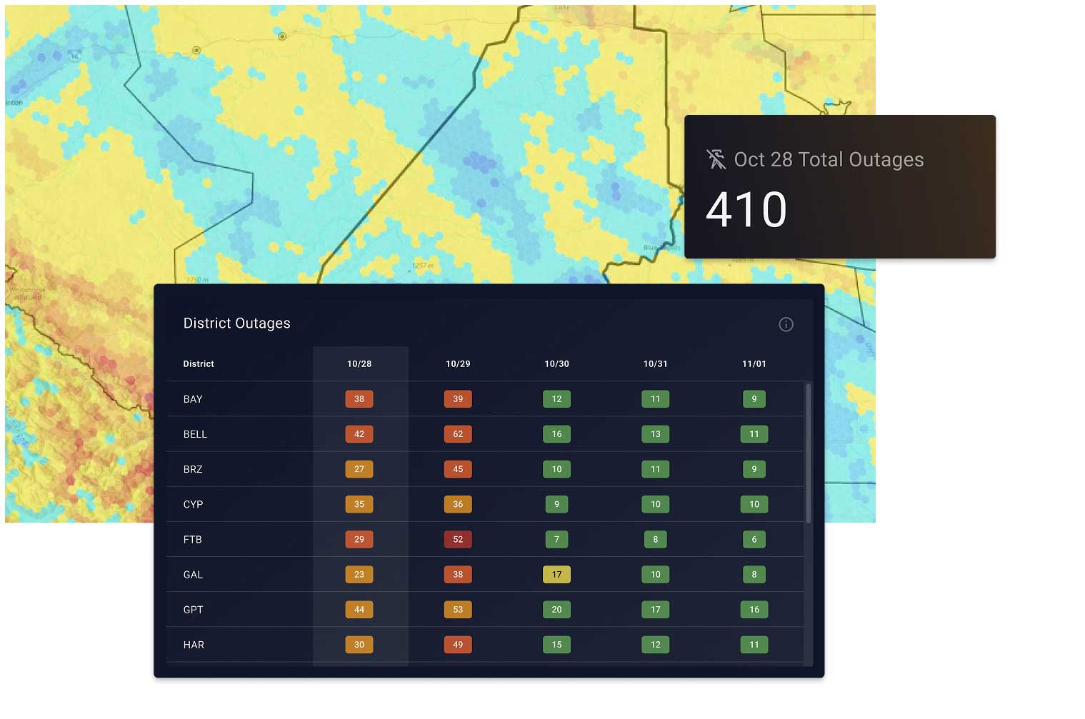
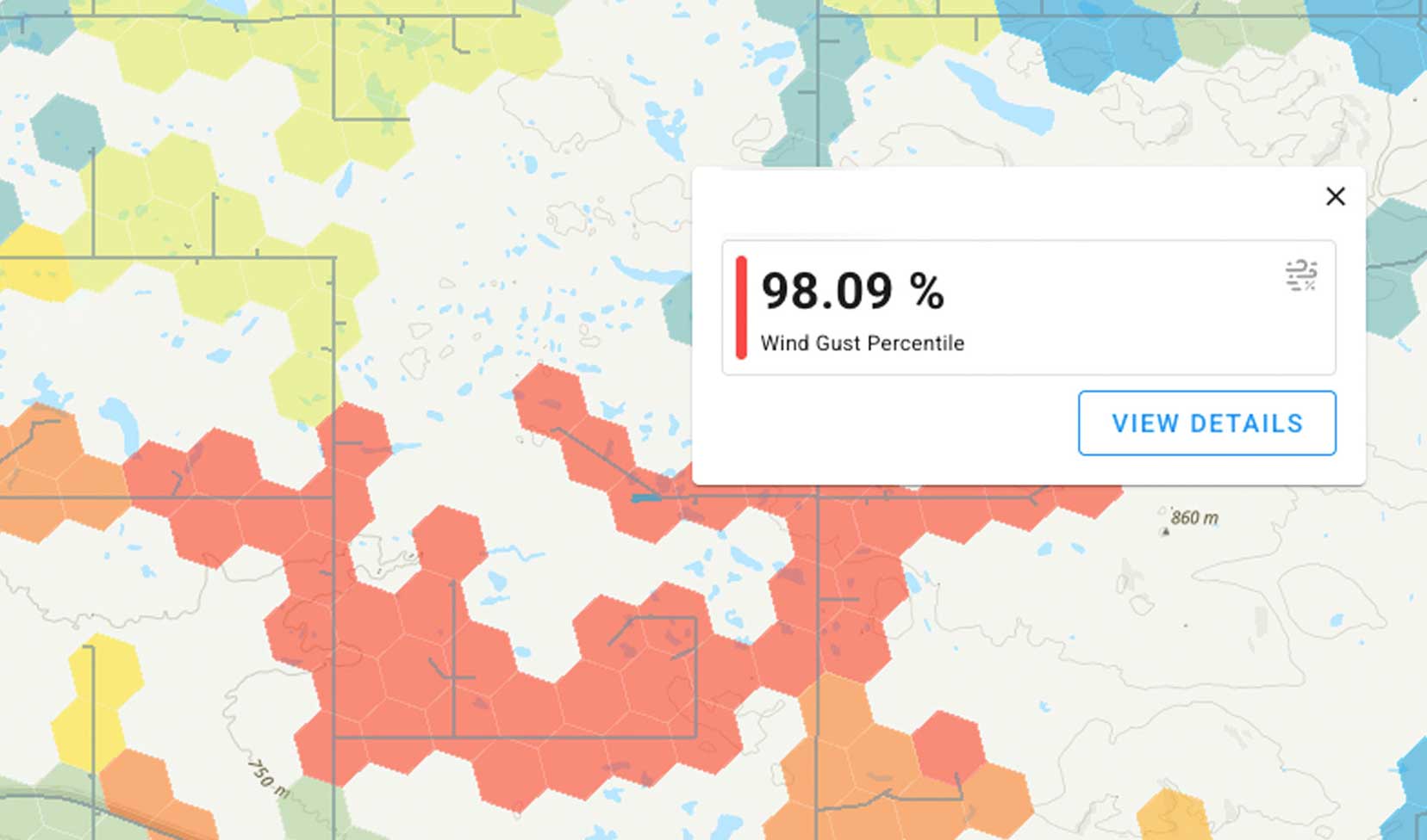
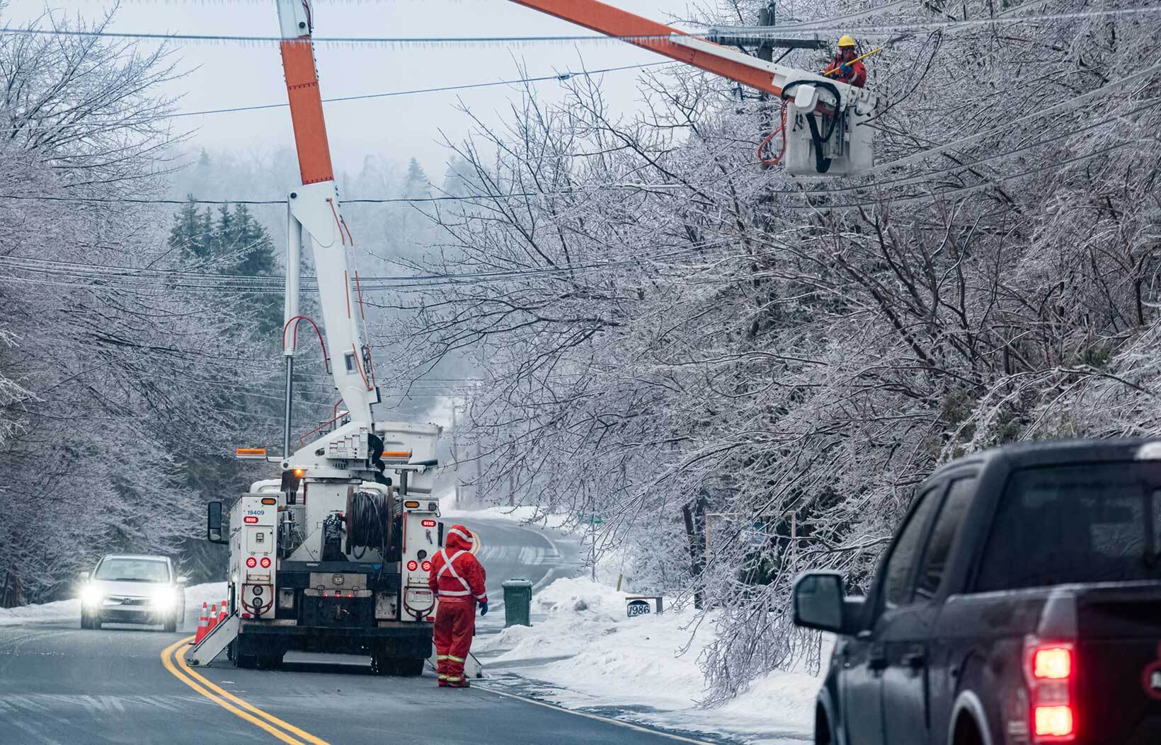
EXTREME WEATHER
Coordinate and mobilize teams.
With AI-enabled models that combine historical utility hazard data with real-time meteorology, our platform supports utilities in responding to high-impact storms days in advance, so utilities can anticipate where outages are likely, what kind of damage to expect, and take informed action to minimize outage times.
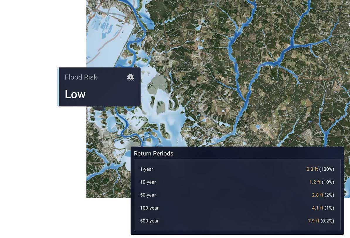
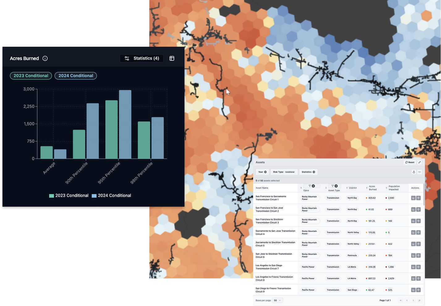
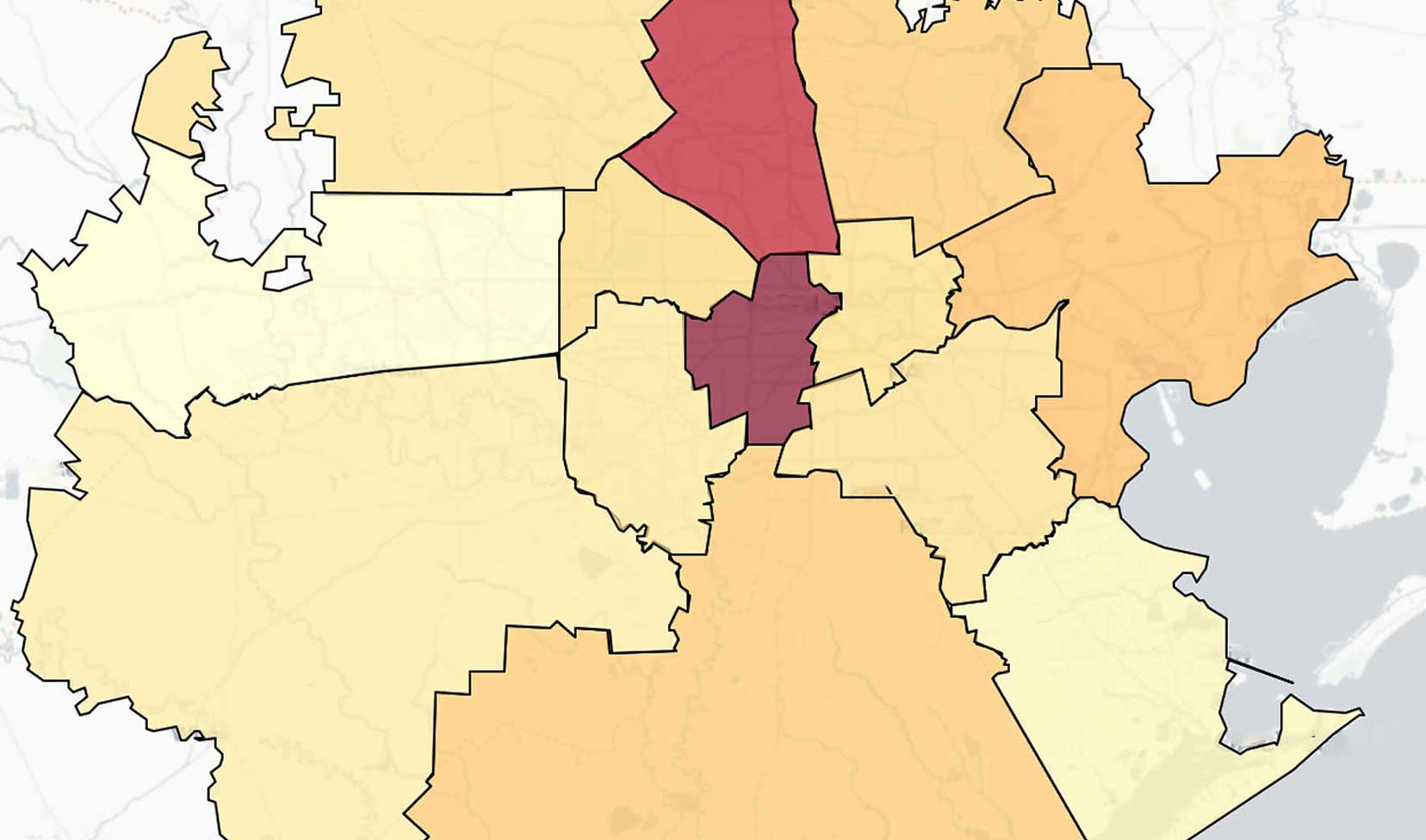
FLOOD
Undertake system hardening and anticipate flood impacts
Planning: see risk at the asset level.
Technosylva’s physics-based flood models provide high-resolution insights and defensible, decision-ready flood intelligence for prioritization and hardening of high-risk, high-impact assets, so you know exactly where to focus and why.
USE CASES
Ensure multi-hazard visibility
Prepare for and respond to wildfires, high-wind events, extreme temperatures, winter storms, and flooding in a single, actionable view.
Surgical PSPS
Know which assets and lines to turn off during a wildfire or extreme weather event – without widespread shutoffs.
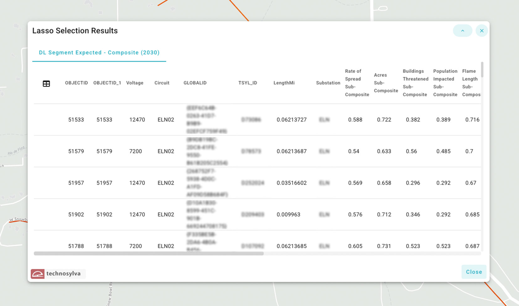
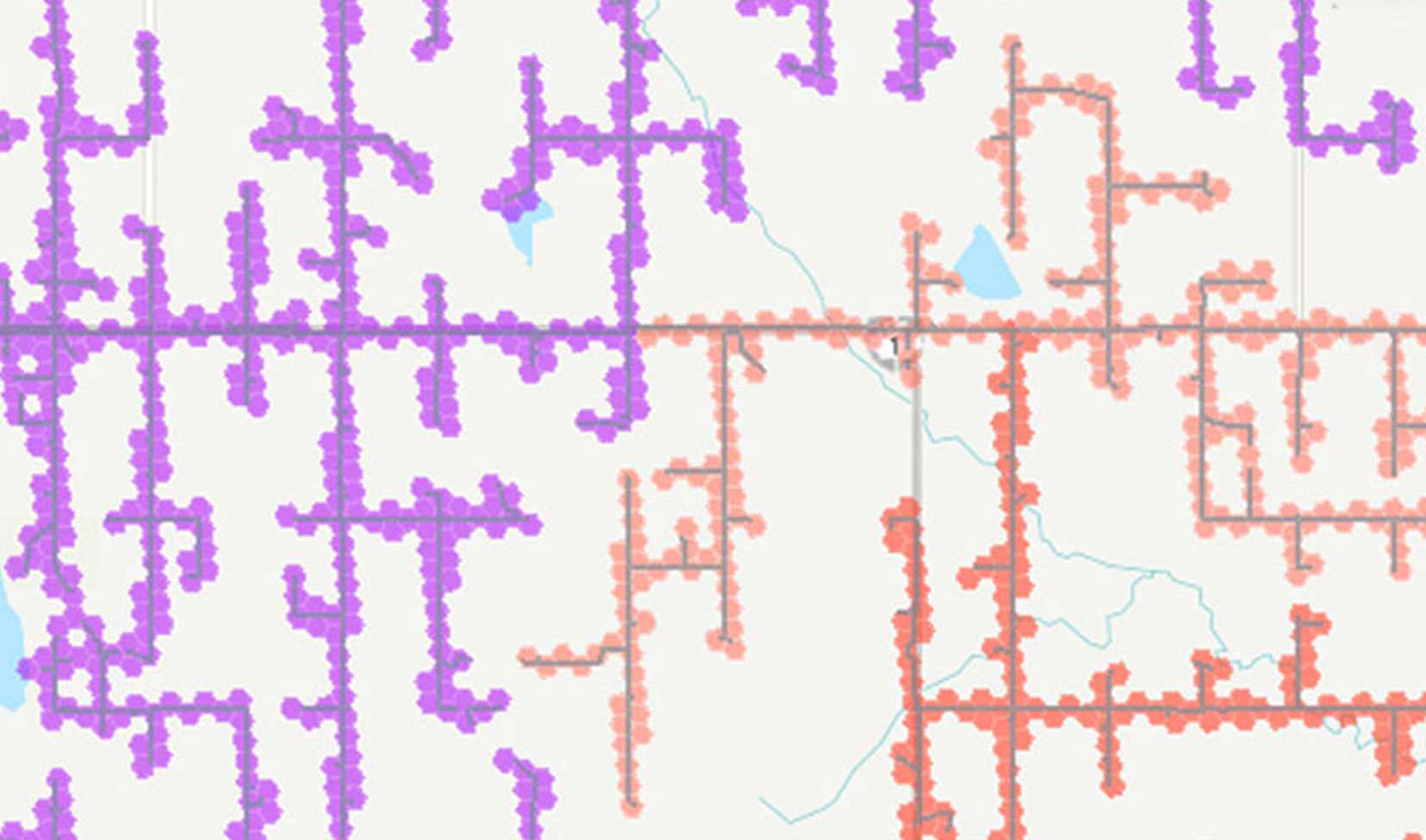
Prioritize Vulnerable Assets
Target inspections and hardening where they deliver the greatest risk reduction and strengthen resilience.
Strengthen Situational Awareness
Gain real-time fire spread predictions and incident updates to support faster, more confident response.
Elevate Your WMP
Use credible wildfire data and insights to prioritize investments and build stronger wildfire mitigation plans.

Target Vegetation Risk
Anticipate likely fire paths to prioritize vegetation management efforts and allocate budgets more effectively.
Prepare for Outages
Quantify outage levels and system damage to restore power faster when events occur.

Improve Reliability Metrics
Identify investments that increase multi-hazard reliability and minimize impacts to SAIDI/SAIFI scores.
Decrease Restoration Costs
Optimize resourcing and positioning with real-time hazard and damage forecasts.