SITUATIONAL AWARENESS
The full picture in one place.
Fragmented data across scattered systems gives a dangerously incomplete assessment of what’s really happening. Our customers, from meteorologists to CEOs, make critical decisions about wildfire and extreme weather events fast with real-time, validated, actionable intelligence in a single view.
Unified real-time detection, predictive modeling, and operational intelligence for operational agility and long-term resilience
There’s no time to second guess.
Electric utilities and fire agencies need operational intelligence based on the latest data, that responds quickly and shows how the future will unfold. As the changing climate drives more frequent and severe events on a national scale, they also face liability and risks to public safety, raising the stakes for the answers to fundamental questions.
- “What’s the real-time wildfire risk to my infrastructure during red flag conditions?”
- “Where should I position crews and resources before a high-risk weather event?”
- “How do I make confident PSPS decisions that protect communities while minimizing impacts?”
- “How do I justify my vegetation management priorities to regulators with defensible data?”
- “How do I coordinate with fire agencies when an incident threatens my assets?”
| The Intelligence Challenge | The One-Platform Solution |
|---|---|
| Fragmented data sources: Critical decisions made with incomplete, inconsistent information from scattered systems | Real-Time Intelligence Integration: One view for detailed weather monitoring, detection, fuels data, UAV, aerial data, remote sensing, and resource tracking |
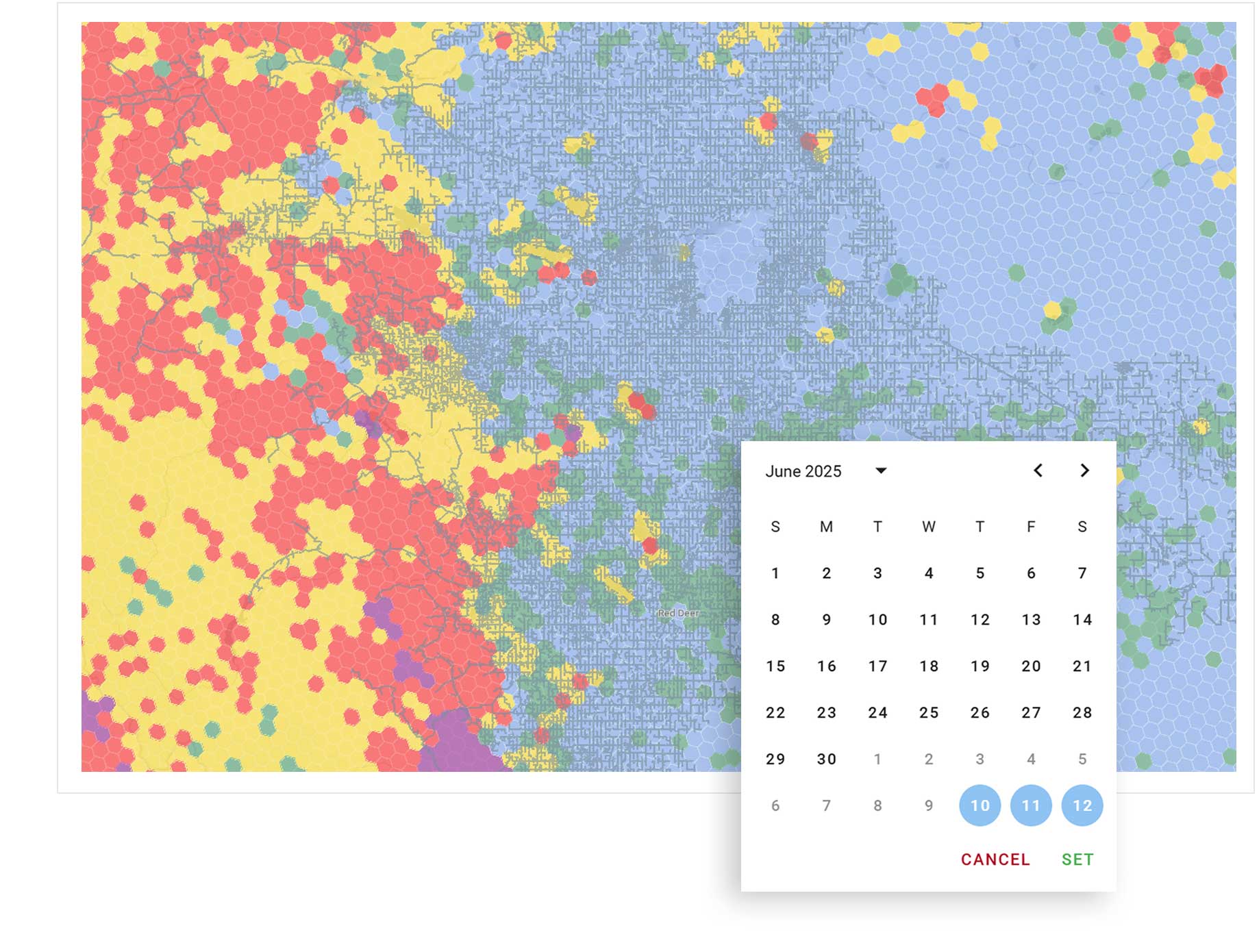
| Delayed response: High-confidence PSPS decisions, resource allocation, customer notification, and emergency response require accurate intelligence with longer lead times | Swift action: 5 day ahead forecasts updated continuously, including weather, asset and territory risk predictions, and fire simulations to provide decision-makers with days for scenario planning and proactive event response |
| Operational complexity: Addressing wildfire risk from vegetation management, planning high-risk weather zones, and coordinating resources requires comprehensive awareness and understanding of exposure to long-tail risk | Operational clarity: Common operational platform that enables hour-by-hour forecasts of risks, consequences, and “what if” scenarios to activate emergency vegetation management, PSPS, and field capabilities. Integrations with other departmental core data and systems |
| Regulatory requirements: Justification of organization-wide wildfire mitigation decisions in high-pressure, time-sensitive situations can be challenging | Defensible reporting: Science proven to withstand regulatory scrutiny and provide transparent, holistic decision-making criteria, backed by a team of experts |
Credible data for confident decisions.
Utilities need consolidated, validated, and accurate data and forecasts to make faster, higher-confidence wildfire decisions. Siloed, inconsistent weather, fuels, risk, and asset information forces reactive responses.
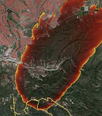
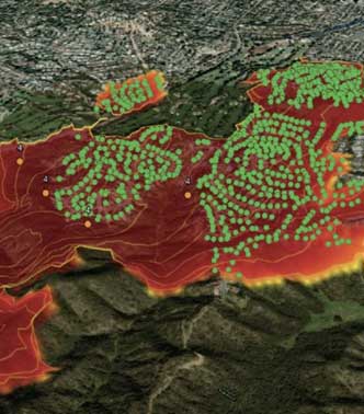
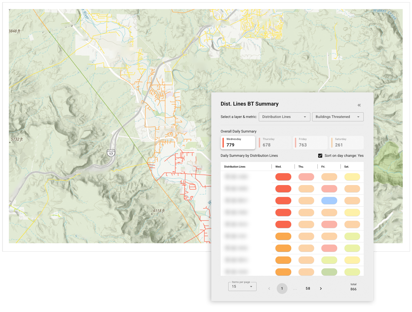
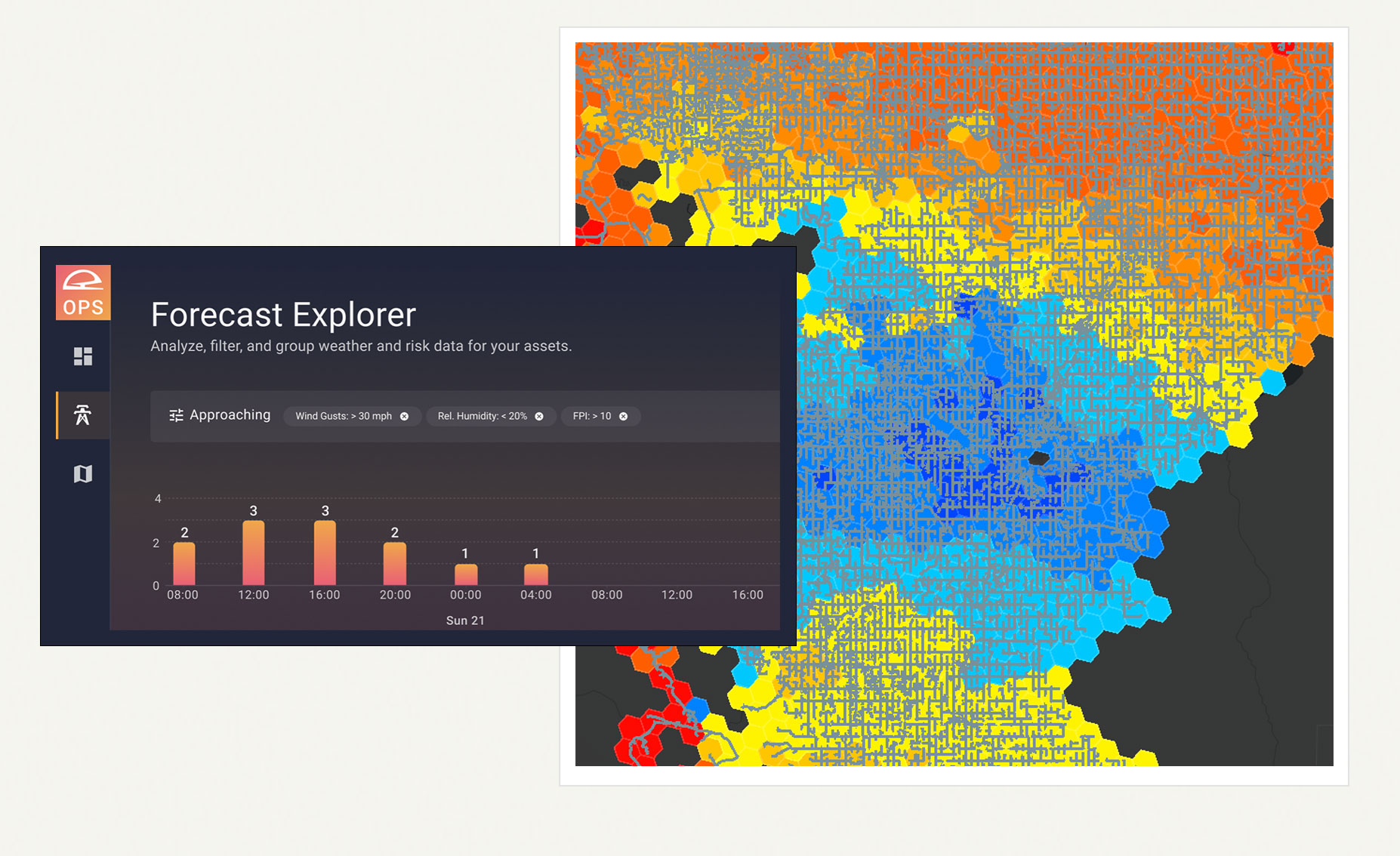
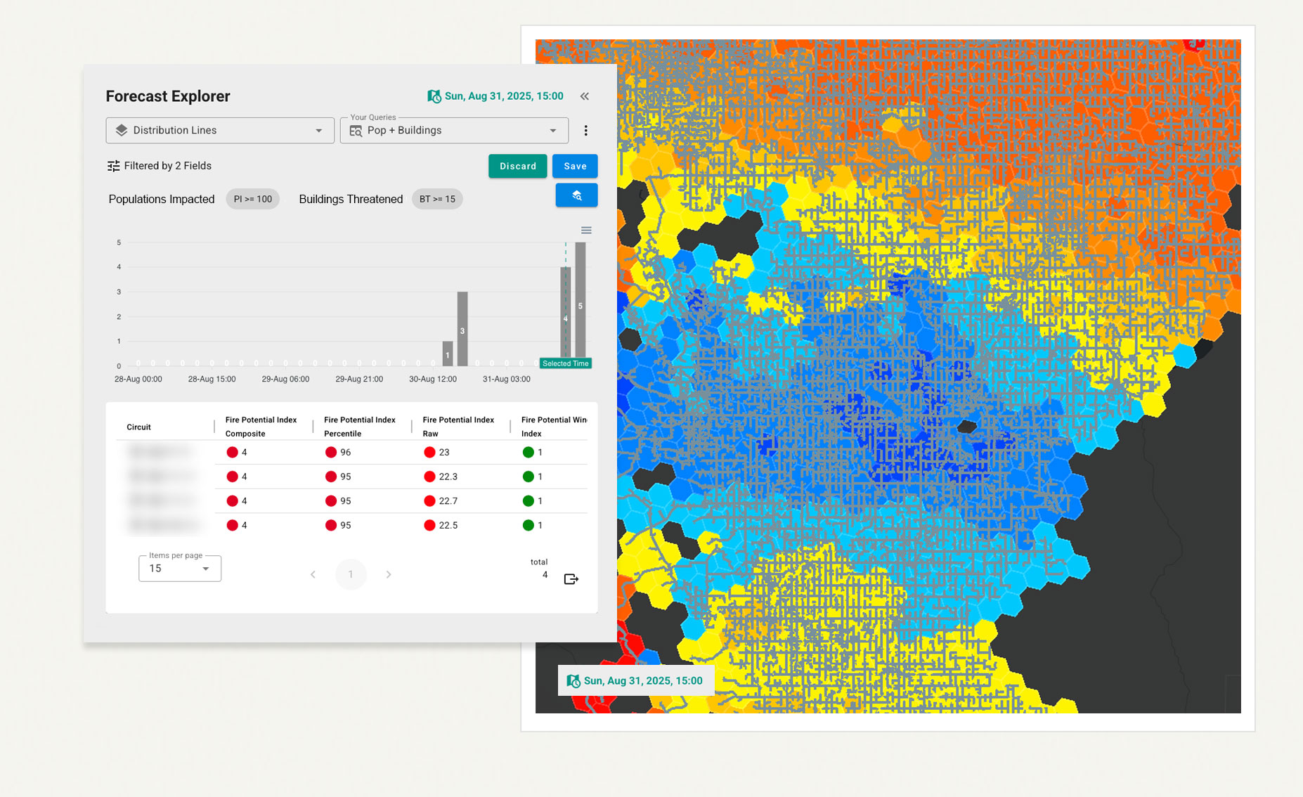
Technosylva uses the world’s largest dedicated supercomputing environment to ensure comprehensive asset-level ignition-risk analysis and real-time insights into driving factors like fuel moisture and wind speeds. This critical detail enables surgical PSPS decisions, targeted vegetation management, and enhanced emergency coordination—improving public safety while minimizing community impacts.
One View
Comprehensive Intelligence Integration
More utilities trust Technosylva’s validated AI-powered technology to integrate multiple intelligence sources to provide defensible data for both operational and strategic actions.
-
Daily risk assessment: Real-time intelligence for operational procedures and staff positioning
Surgical PSPS decision support: Integrated weather, wildfire and extreme weather risk, and impact data that enables highly targeted de-energization decisions
Resource coordination: Proven pre- and in-event tracking and management of field crews, equipment, and emergency response resources
Vegetation management intelligence: Identify high wildfire and extreme weather risk areas and prioritize vegetation activities
Optimize staff safety: Know when to change procedures or reposition crews based on real-time intelligence
Acquire and station resources: Use predictive intelligence for proactive resource positioning and emergency preparedness, including smart mutual assistance
-
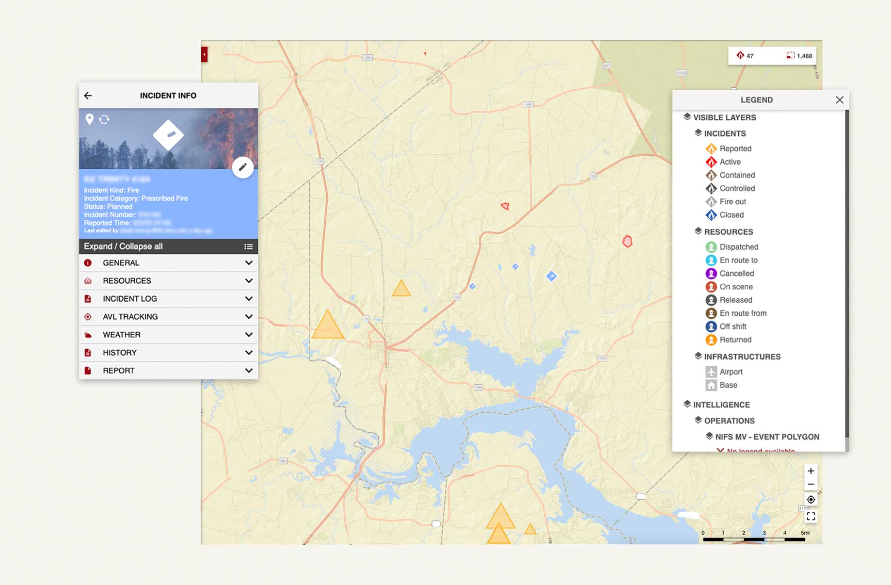
Incident management: Real-time resource tracking and incident mapping with disconnected field capabilities
Multi-agency coordination: Common operational picture enables seamless data sharing across agencies
Predictive intelligence: Weather and fire behavior forecasting for proactive resource positioning
Safety enhancement: Comprehensive awareness of threats, resources, and operational conditions
Comprehensive awareness: Integrate tactical field data with broader operational intelligence for complete awareness
-
Wildfire and extreme weather risk zone identification: Intelligence to support high fire risk zone planning and resource allocation
Infrastructure assessment: Situational data to inform grid planning and asset management decisions
Compliance support: Generate defensible data for regulatory reporting and decision documentation
High fire risk zones: Use intelligence to identify and plan for high-risk areas requiring special attention
Model community impact: Understand potential consequences to support decision-making and regulatory compliance
Validated again and again.

Operational scale:
20,000+ incidents managed annually

Continuous intelligence:
Over 1 billion daily simulations
Customer trust:
Used by CAL FIRE, PG&E, Xcel Energy, and over 20 leading utilities
Regulatory validation:
Technosylva data in more approved WMPs than any other technology
Battle-tested reliability:
Proven performance during high-risk wildfire and extreme weather incidents